Our Survey Services
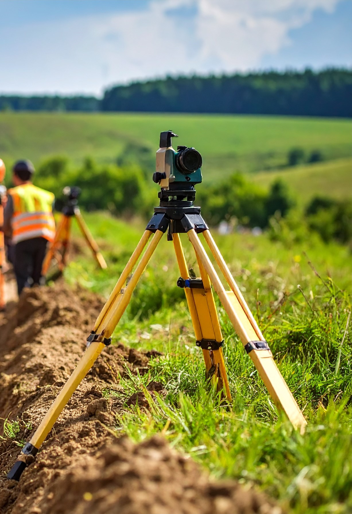
At Royal Crown Engineering Ltd, we offer comprehensive surveying solutions tailored to your specific needs. Our team of professionals utilizes state-of-the-art equipment and advanced methodologies to deliver accurate and reliable results for projects of any scale.
Boundary Surveys
Precise Property Line Determination
Our boundary survey services provide accurate determinations of property lines and corners, establishing the legal boundaries of your land. We conduct thorough research of land records, analyze previous surveys, and perform precise field measurements to ensure the highest level of accuracy.
Whether you're purchasing property, planning to build, resolving a boundary dispute, or simply want to know the exact boundaries of your land, our experienced surveyors will deliver reliable results that stand up to legal scrutiny.
Our Boundary Survey Services Include:
- Property corner marking and monumentation
- Boundary line staking
- Research of deeds and historical records
- Resolution of conflicting boundary evidence
- Legal descriptions and plat preparation
- Expert testimony for boundary disputes
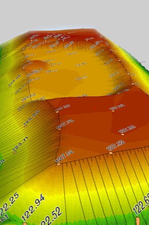
Topographic Surveys
Detailed Terrain Mapping
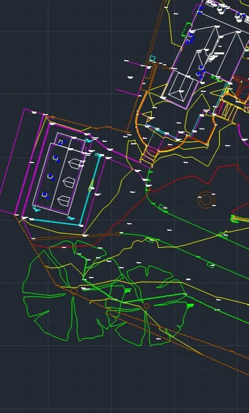
Topographic surveys create detailed maps of the land's surface features including elevations, contours, and existing improvements. These surveys are essential for engineering design, site planning, and construction projects.
Using advanced technologies including drone mapping and 3D laser scanning, we capture comprehensive data sets that provide accurate representations of terrain and structures. Our detailed topographic surveys help architects, engineers, and developers make informed decisions about site development.
Our Topographic Survey Services Include:
- Contour mapping and elevation determination
- Location of existing buildings, utilities, and structures
- Aerial mapping with drone technology
- 3D terrain modeling and visualization
- Volumetric calculations for earthwork
- Digital files compatible with CAD and GIS systems
Construction Surveys
Precision Layout for Building Projects

Construction surveys provide precise layout data for building projects, ensuring that structures are built exactly according to design specifications. From initial site layout to final as-built documentation, our construction survey services support every phase of your project.
Our experienced field crews use robotic total stations and GPS technology to provide precise staking and layout services. We work closely with contractors and project managers to ensure accurate implementation of design plans and efficient project execution.
Our Construction Survey Services Include:
- Building layout and foundation staking
- Road and utility alignments
- Construction staking for site improvements
- Cut and fill grade establishment
- As-built surveys for completed projects
- Construction monitoring and verification
Earth Work Quantities Services
Precise Cut and Fill Calculations
Our Earth Work Quantities services provide accurate calculations of cut and fill volumes for construction and development projects. We use advanced surveying techniques and software to determine the precise amount of earth that needs to be moved, helping you optimize your project planning and budgeting.
From small site preparations to large-scale infrastructure projects, our experts deliver reliable quantity calculations that help minimize earthmoving costs and ensure efficient project execution.
Our Earth Work Services Include:
- Cut and fill volume calculations
- Mass haul diagrams and analysis
- Terrain modeling and analysis
- Grading optimization
- Material quantity estimation
- Progress tracking and reporting